


Three weeks into my Alaskan trip, I took a break from the research (forced break due to sudden alpine tundra rainfall), and travelled down to Skagway to meet my family (they were doing a tour of Alaska whilst I was slaving away.) On one of the days, we decided to try something completely brand new for the family – doing a wilderness hike and canoe expedition to see Davidson Glacier.
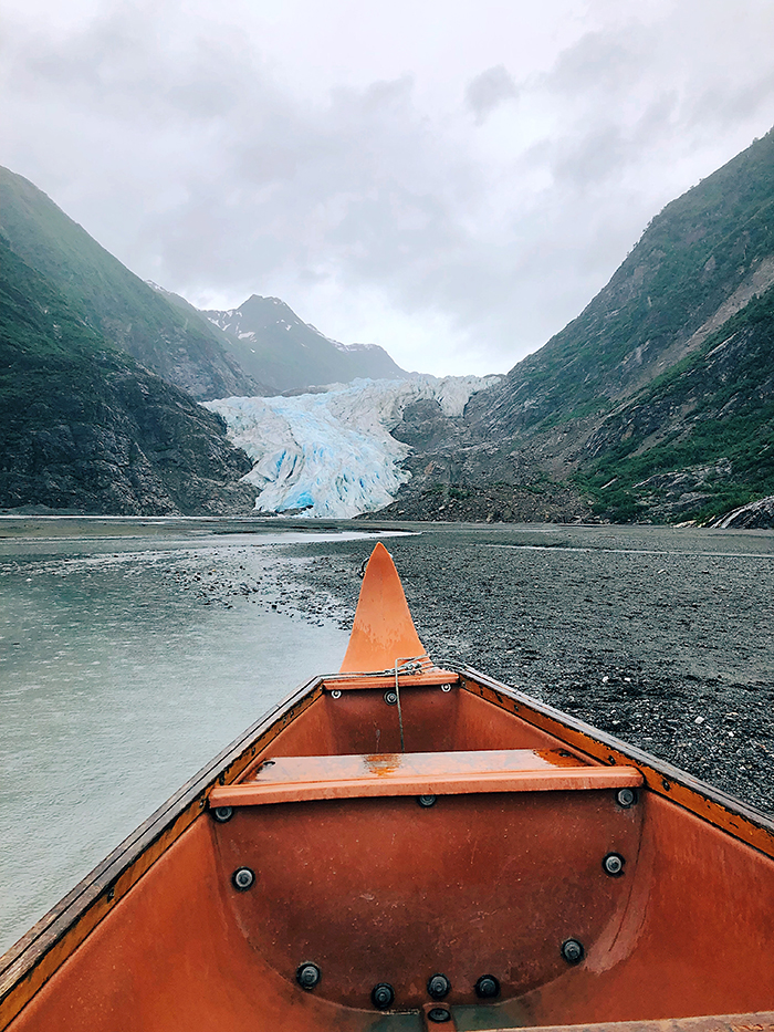
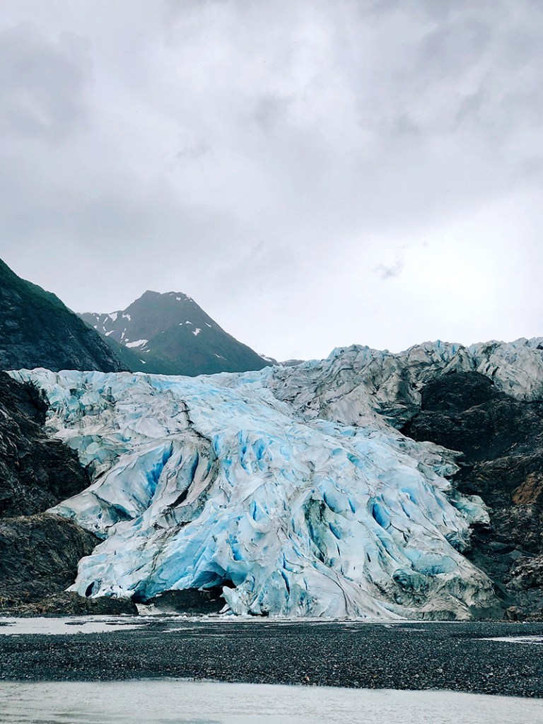
Davidson Glacier was originally discovered in 1867, and made famous by the Father of National Parks, John Muir, when he recounted it in his travels around Glacier Bay just a decade later. It used to be almost a tidewater glacier, but has receded into the mountains over the last century, turning into a valley glacier with its own glacial lake (so far up we can’t see it.) It’s currently runs for about 4.6 miles.
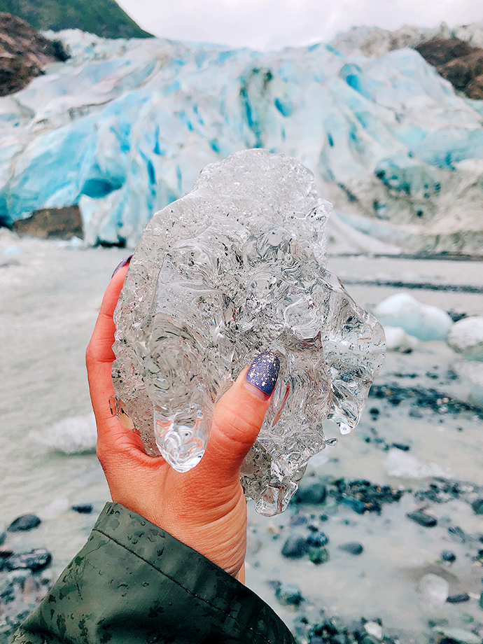
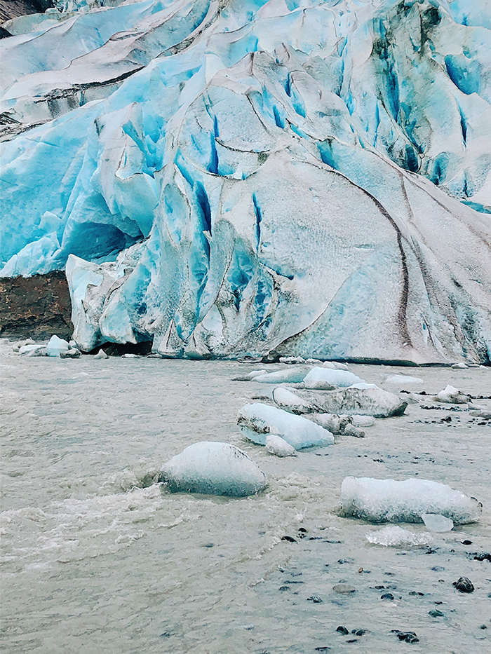
A couple of months back, I was reading The Popular Science Monthly from June 1889 (for research, not for fun), Glaciers on the Pacific Coast by G. Frederick Wright, where he estimated the original front of the glacier to be a whopping 3 miles wide. Unfortunately, there is no speculation on the length it used to be then. It’s said some Russian scientists tried to explore, but it went so far back and that they weren’t ‘heard from again’, but it’s likely it was due to lack of communication rather than death, I would think. Anyway, as you can see from my photos above, there is no 3 mile wide glacial front and it’s hard to imagine one. It’s crazy to learn the theory and science behind changes in our natural environment, then experiencing it firsthand.
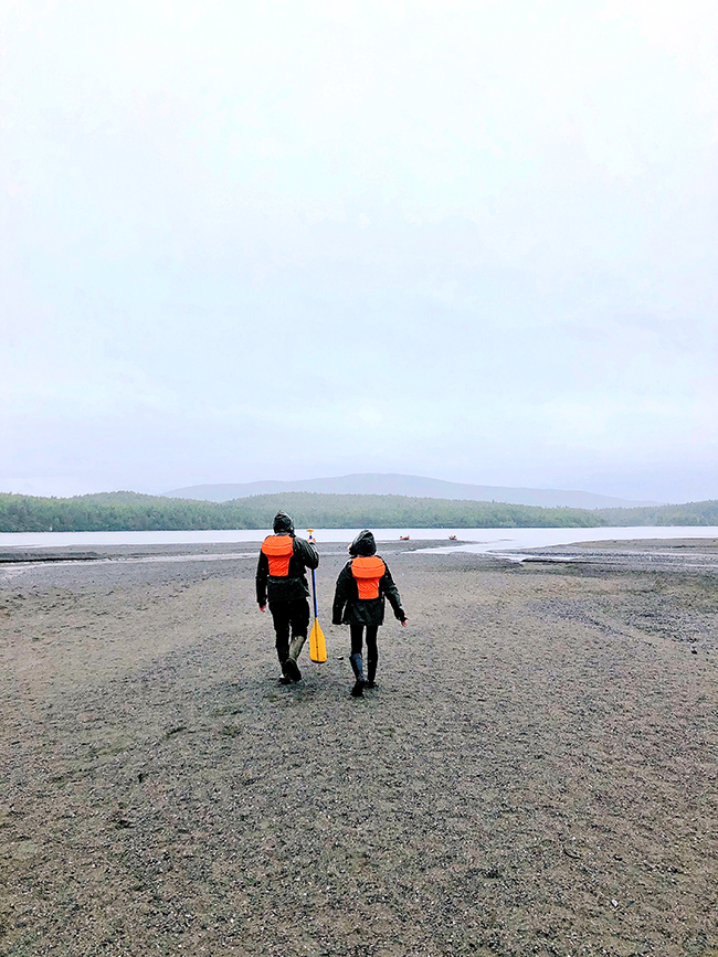
The weather in Alaska changes like the drop of a hat, and our guides shared that while the morning storm passed a couple of hours ago, there were still chances of a drizzle or more. As expected, plans changed according to the weather situation. After briefing and being outfitted, we took a speedboat to Glacier Point where we begun our relatively short mile hike on uneven terrain (lots of interesting vegetation, but rarely any wildlife) then canoed upstream. Halfway through our rowing, the drizzle turned into stormy wind and hail fell. However, our guides deemed it safe for us to proceed. Wildlife became scarce the closer we got upstream to the glacial waters, and the water was murky.
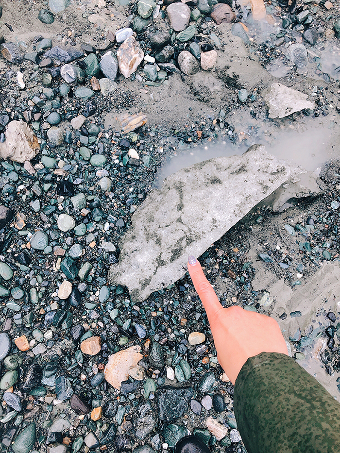
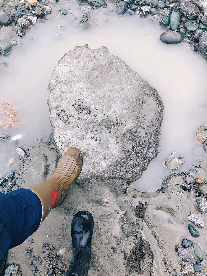
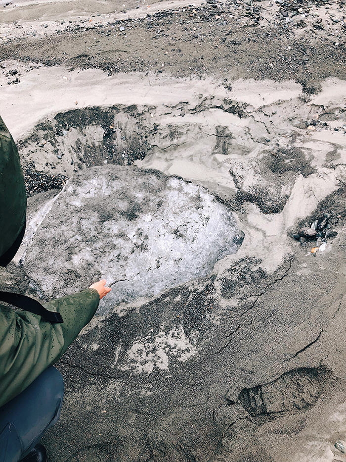
To safely navigate the landscape, we learned about kettle holes on outwash plains formed by retreating glaciers, resulting in misleading puddles of water that could be over 5 feet deep. Our guides taught us how to use our canoe paddles to test the depth before walking through them.
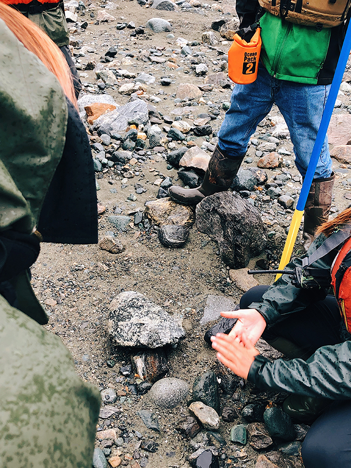
We hiked over what was a river (just 24 hours ago) and learned about sand formations underwater. Due to the erratic weather, the glacier shifted through the early morning, and resulted in water blockage that choked the water source. We could see water flow patterns, which is rare. During the hike, we also managed to learn about fossil formations on rocks by glacial pressure (aka earth art.) It’s incredible to see the different combinations of sediment and earth that form together over years, producing a wide variety of little pebbles and rocks.
Towards the end of our visit, the storm threatened to come back, and we witnessed a giant chunk of glacial ice calve. It ended up sitting and waiting for the river to rise. Within the span of an hour hobbling around the glacier, the water level rose a foot and we had to speed hike back to the canoes before the river came back and washed us away.
This turned out to be such a terrific experience, and I would recommend it for all adults (with a little bit of training and some persistence in difficult weather.) However, I would not suggest bringing a phone or a camera with them unless it was waterproof (not water resistant.) Shortly after our little adventure, my phone died thanks to the extreme weather conditions and I had to get a new one. But hey, these pictures were really fun to take too. My dad has a collection of these photos hung up on the wall of his study room now, and that seems to be well worth it.
